Pakistan Launches Remote Sensing Satellite with China’s Help to Boost Development and Disaster Management
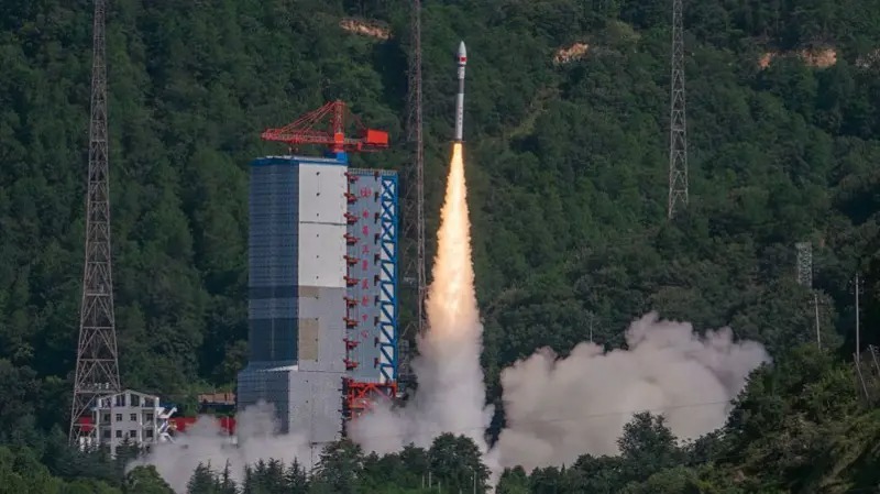
Kathmandu, July 30: In a major step towards enhancing its technological capabilities, Pakistan has successfully launched a remote sensing satellite from China’s Sichang Satellite Launch Center, according to a statement issued by Pakistan’s Foreign Ministry.
The satellite, developed by Pakistan’s space agency SUPARCO in collaboration with Chinese firms CETC and Microsat, is designed to provide high-resolution imagery for a variety of national purposes. The data will be used in urban planning, infrastructure development, agriculture monitoring, natural disaster response, and climate change tracking, the ministry said.
“The satellite will send high-quality images which will be used to help Pakistan plan cities, develop roads and buildings, deal with natural disasters, monitor agriculture, monitor climate change etc.,” the official statement read.
This launch marks a significant milestone in Pakistan’s space ambitions and aims to support sustainable development goals while improving the living standards of its citizens, the ministry added.
Experts say this move strengthens China–Pakistan space cooperation and signals Islamabad’s intent to invest more heavily in space-based technologies for civil use.
Facebook Comment
Related News


latest Video
Trending News
- This Week
- This Month